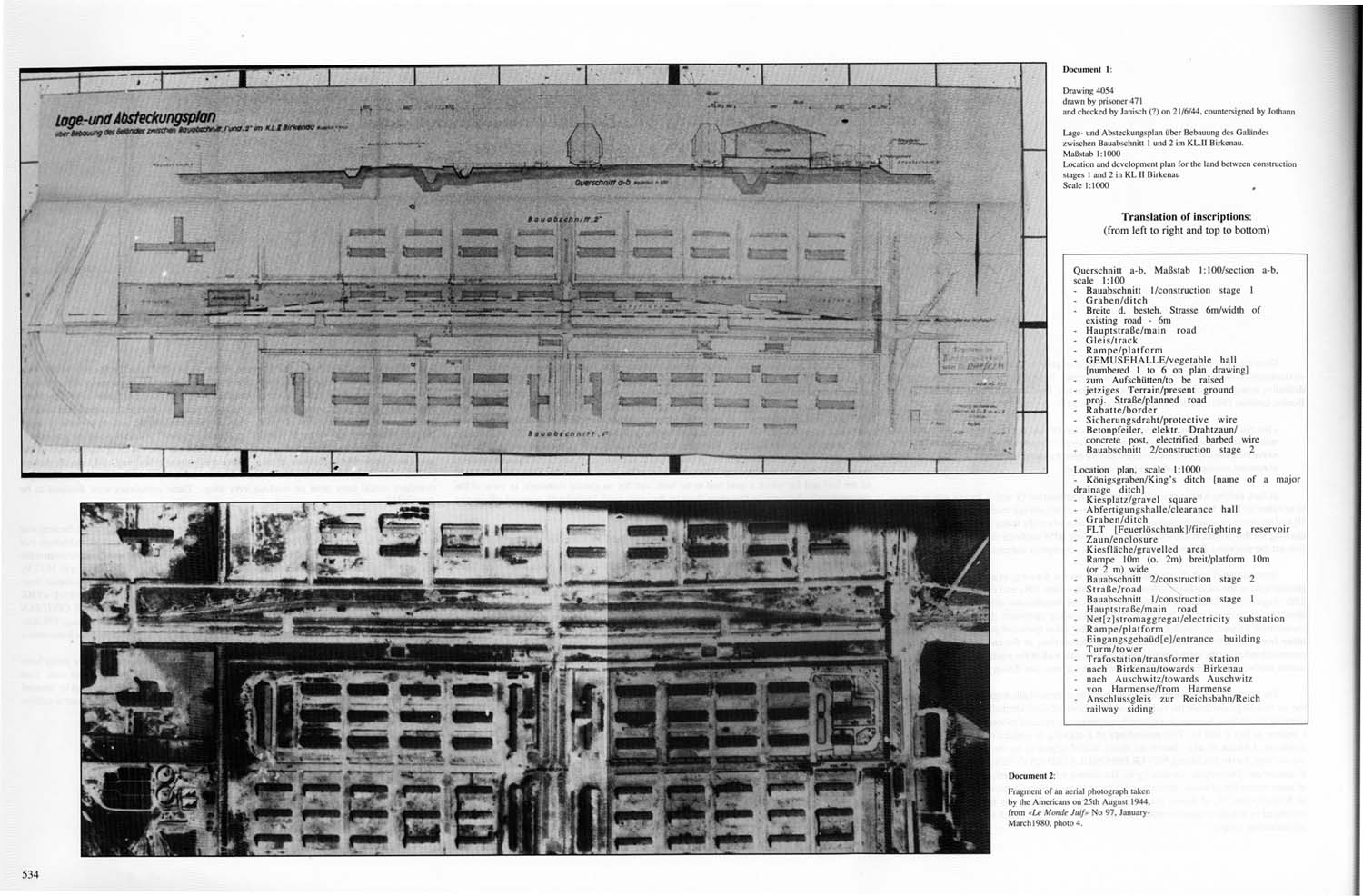
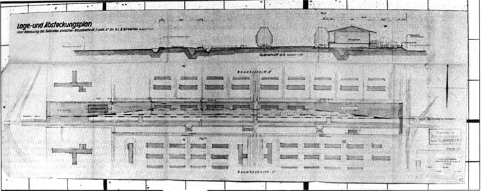
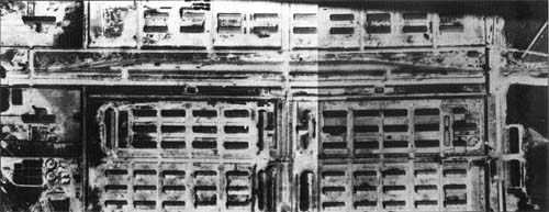
Translation of inscriptions:
(front left to right and top to bottom) |
| |
| Querschnitt a-b. Maßstab 1:100 / section a-b. scale 1:100 |
Location plan. scale 1:1000 |
| · |
Bauabschnitt I / construction stage 1 |
· |
Königsgraben / King’s ditch [name of a major drainage ditch] |
| · |
Graben / ditch |
· |
Kiesplatz / gravel square |
| · |
Breite d. besteh. Strasse 6m / width of existing road — 6m |
· |
Abfertigungshalle / clearance hall |
| · |
Hauptstraße / main road |
· |
Graben / ditch |
| · |
Gleis / truck |
· |
FLT [Feuerlöschtank] / firefighting reservoir |
| · |
Rampe / platform |
· |
Zaun / enclosure |
| · |
GEMUSEHALLE / vegetable hall
[numbered 1 to 6 on plan drawing] |
· |
Kiesfläche / gravelled area |
| · |
zum Aufschütten / to be raised |
· |
Rampe 10m (o. 2m) breit / platform 10m (or 2 m) wide |
| · |
jetziges Terrain / present ground |
· |
Bauabschnitt 2 / construction stage 2 |
| · |
proj. Straße / planned road |
· |
Straße / road |
| · |
Rahatte / border |
· |
Bauabschnitt 1 / construction stage 1 |
| · |
Sicherungsdraht / protective wire |
· |
Hauptstraße / main road |
| · |
Betonpfeiler, elektr. Drahtzaun / concrete post, electrified barbed wire |
· |
Net[z]stromaggregat / electricity substation |
| · |
Bauabschnitt 2 / construction stage 2 |
· |
Rampe / platform |
| |
|
· |
Eingangsgebaüd[e] / entrance building |
| |
|
· |
Turm / tower |
| |
|
· |
Trafostation / transformer station |
| |
|
· |
nach Birkenau / towards Birkenau |
| |
|
· |
nach Auschwitz / towards Auschwitz |
| |
|
· |
von Harnsense / from Harmense |
| |
|
· |
Anschlussgleis zur Reichsbahn / Reich railway siding |
|